Hyperspectral Imagery for Morpho-Spectral Recognition of Urban Features
Project details
Space Application Center - ISRO
2017
Research
CAG
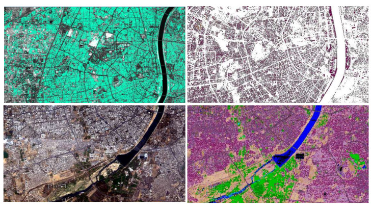
A collaborative project involving NASA, the Space Application Centre (SAC) Ahmedabad, and the Center for Applied Geomatics (CAG) has explored the potential of urban object detection using hyperspectral imagery from the Airborne Visible-Infrared Imaging Spectrometer - Next Generation (AVIRIS-NG). This instrument, designed for natural resource exploration and greenhouse gas research, provides high-quality imaging spectroscopy measurements in the solar reflected spectral range.
The project had two primary goals. Firstly, it aimed to analyze the composition of urban land cover materials and identify different building roof types using aerial spectral data. Secondly, it sought to categorize urban areas' impervious and previous land cover types. To achieve this, we generated two object-oriented databases, a vector database for recognized objects and a geometric attributes database, which included measurements such as texture, compactness, connectedness, voids, surface area, number of edges, and boundaries.
The project focused on harnessing the combined power of spatial and spectral dimensions offered by hyperspectral imagery. The spectral dimension precisely discriminated various urban materials based on their unique spectral signatures. The study area was classified into 38 distinct classes, including different types of building roof materials, pavements, roads, soil, vegetation, and water bodies, using the Spectral Angle Mapper. We also created a spectral library consisting of known materials for classification purposes. The accuracy assessment was conducted for the classification using a confusion matrix, revealing an overall accuracy of 85.90% and a Kappa coefficient of 0.84.
More Projects from CAG