Use of 3D LiDAR Scanning Technology for Documentation of Historic Buildings
Event
Fri, March 12, 2021 - Mon, March 15, 2021
10:00 am
Site School: Tankshal ni Pol, City Survey no. 603, Kalupur Ward 1
About the workshop:
Advancement in technologies is opening up new ways of data capture, processing and representation of the information. Digital tools such as 3D scanning are providing increasingly detailed and accurate information within a relatively shorter time span. The workshop will focus on the technical and practical aspects of the 3D LiDAR Scanning technology.
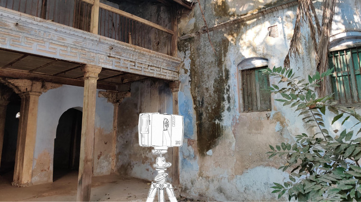
The topics will include the basics of LiDAR operations, prerequisites for site preparation, an overview of data collection and post-processing. Additionally, the workshop features live demonstrations of the FARO x330 scanner by the experts. Participants will be able to understand the possibilities, limitations and resources required for the use of this technology.
This is the first of the series of workshops planned at the Conservation Site School - an initiative by the Center for Heritage Conservation in the historic city of Ahmedabad. The workshop is organised in collaboration with Shayona Management Services Pvt. Ltd. - a specialised agency in Building Information Modelling (BIM) and LiDAR Scanning.
Schedule:
Day 1 - Friday, 12th March
Mode: Online presentation + Discussion
- Introduction to the principles of documentation and recording.
- Introduction to the technology of 3D LiDAR Scanning Application of the technology for documentation of historic buildings.
- Understanding the pre-requisites of the scanning process.
Day 2 - Saturday, 13th March
Mode: Onsite
- Scanning interior of the site Exploring and understanding the historic building and its context.
- Retrospection of manual documentation of the building.
- Understanding the aims and objectives of the digital methods of documentation.
- Introduction to 3D scanner and allied equipment. Understanding operational requirements and handling of the equipment.
- Identification, selection and setting of the scanning points.
Day 3 - Sunday, 14th March
Mode: Onsite
- Scanning exterior of the site.
- Limitations and challenges.
- Demonstration of data collection.
Day 4 - Monday, 15th March
Mode: Online demonstration + Discussion
- Introduction to the processing software.
- Demonstration of transfer and processing of the data in the software.
- Extracting the point cloud data to AutoCAD.
- Sample demonstration of processing of the point cloud data to generate the line drawing.
Certificate:
Participants will receive the certificate on successful completion of the given assignment based on the reference material and processing of the sample point cloud data to generate a line drawing.
Learning Outcome:
The workshop aims to give the participants a fundamental knowledge of the latest ground-based LiDAR technology with a focus on pre-requisites of the usage of the technology and practical demonstrations. At the end of the workshop, the participants will be well versed with the working principle of LiDAR scanning and will know how the technology can be exercised to capture the 3D of historic buildings.
Note:
Reading material and safety equipment will be provided during the onsite session.