National symposium on industry-academia collaboration for geospatial technologies - 2019
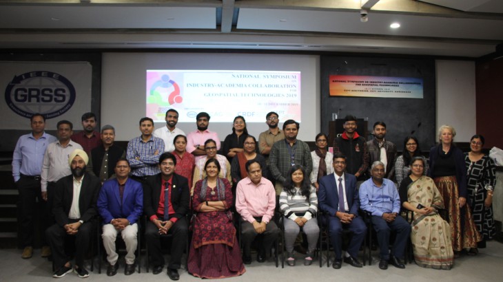
The National Symposium on Industry-Academia Collaboration for Geospatial Technologies held on 10th -11th December-2019 Organized in Collaboration with IEEE-GRSS by Center for Applied Geomatics (CAG), CRDF, CEPT University, Ahmedabad.
The National Symposium had a focus on setting out innovative trends and technology-driven attitude through the ideas shared by industry and academia experts. It emphasised on understanding the concepts of Geospatial Technology and the way it could be useful in bringing the stakeholders together through the participation of academia, industry, and government. Experts, researchers, and decision-makers from all these organizations joined hands and discussed the emerging trends in geospatial, the goals of industry and the role of academia in reaching and building the capacity for the government. Vision on GIS industries and trends, deciding road maps in GIS and have better visibility in working together for the benefit of the society at large and to the stakeholders of geospatial technology. The symposium had fulfilled the aim to provide a platform for the exchange of thoughts, sharing of experiences and discussion on the use cases among the stakeholders and young researchers about the issues related to Geospatial Technologies and derived a ‘Statement of Sustainable Strategy’ for the stakeholders.
Participants and speakers came from various departments of Government, Industry, and Academia across the nation. Inaugural function started with a welcome address, about the IEEE, CAG & CEPT University and the description of the programme schedule followed by the self-introduction of the participants. The invited speakers were introduced before their twenty minutes presentation on the topic assigned to them in advance.
There were four lectures scheduled per thematic session on Industry, Academia and Government. Longer time was allocated for the discussion forum where all participants can contribute their perceptions and experience. Lectures delivered on different themes such as Geospatial Technology for Government and Projects, Map Data Policy, UN support to Academics and Government, Monitoring Gap between Advancements in Geospatial Technology Trends and Capacity Building.
The participants were grouped with representation of all three stakeholders. The questions were put before these groups and were given time ranging from 3 -12 minutes, the groups were asked to note down the answers. Those were placed on the Tag Board in a hall. During Plenary Session, a project was discussed. A Participatory Learning Method was adopted. At the end of the programme, a list of volunteered stakeholders was formed to continue the discussion and bring out the mechanism of collaboration.
It was a successful end with thematic delivery of lectures, lots of brain-storming discussions, projectisation and formation of a group of the people representing from all three stakeholders for the collaboration. The National Symposium was a effective event, informative for all the stakeholders and researchers in terms of issues, challenges and possible solutions for addressing the real-time, real-world problems of society with the help of cutting-edge geospatial technology.